New Parallel version of Hydrologic Terrain Analysis Software TauDEM

Published: Mar 5, 2012 by ISG Board

Geomorphometry followers may be interested in the new version of my TauDEM (Terrain Analysis Using DEMs) software available from http://hydrology.usu.edu/taudem.

TauDEM is free and open source. It comprises a set of Digital Elevation Model (DEM) tools for the extraction and analysis of hydrologic information from topography as represented by a DEM.

The new version, TauDEM 5.0 takes advantage of parallel programming using the message passing interface (MPI) and achieves improved runtime efficiency and the capability to run larger problems.

TauDEM includes functions for the development of hydrologically correct (pit removed) DEMs, calculation of flow paths, contributing area, stream networks and other flow related derived information. Its unique features are that it uses the D-Infinity flow model for evaluation of information derived from dispersed flow over hillslopes and provides objective methods for the determination of stream network delineation thresholds.

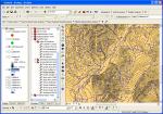
The parallel version (TauDEM 5.0) has been completely restructured as a set of command line functions in standard C++ using MPICH2. The source code has been compiled for both PC’s and parallel clusters. GeoTiff is used as the input/output file format so that the command line functions that provide core functionality are platform independent. TauDEM does include an ArcGIS toolbox Graphical User Interface (for ArcGIS 9.3.1) that has been recoded to use system calls to these command line executables.

The development of TauDEM 5.0 was supported by the US Army Engineer Research and Development Center under contracts W9124Z-08-P-0420 and W912HZ-09-C-0112.

story hydro software arcgis

Share

Latest Posts

Cover Design Contest for the Upcoming Book on Geomorphometry

Dear geomorphometry community,

We are pleased to invite submissions for a cover design contest for the second edition of the Geomorphometry book, to be published in 2026.

The submissions will be gathered in a poll, and the entire community will be able to vote for their favorite design.

If your design is selected, you will receive the appropriate credits, but would need to provide the necessary permissions to use the image.

You can submit your design by email before October 17th. Please ensure that the image is of at least 300 dpi resolution.

Get designing!

The editors,
Hannes Reuter
Carlos Grohmann
Vincent Lecours

Coffee Talk - Recent Research Progress in Geomorphometry in China

Recent Research Progress in Geomorphometry in China

Dr. Li-Yang Xiong
Nanjing Normal University, China

October 1st , 2025
8:00 MDT (UTC -6), 10:00 EDT (UTC -4), 11:00 BRT (UTC - 3), 15:00 BST (UTC +1), 16:00 CEST (UTC +2), 17:00 EEST (UTC +3), 22:00 CST (UTC +8)

Recording available in our YouTube channel

Bio: Dr. Li-Yang Xiong is a professor at the School of Geographical Science, Nanjing Normal University (NNU), China. He is currently responsible for managing NNU’s research in Digital Terrain Model and Digital Terrain Analysis. His main research interests include AI based terrain modelling, loess terrain feature characterization, landform evolution modeling, paleotopography reconstruction and geomorphological process mining. His recent work involves deep learning-based DEM reconstruction, geomorphology-oriented digital terrain analysis, and value-added digital terrain applications for geoscience. He also serves as Associate Editor for the journal Earth Surface Processes and Landforms and as an Editorial Board Member for International Journal of Geographical Information Science.

Abstract: In this talk, I will present some recent research achievements related to terrain modelling theory, terrain analysis method and terrain application in China. This terrain modeling theory focused on how we understand terrain knowledge and integrate it into AI methods for terrain reconstruction. In term of the terrain analysis method, the mathematical vector operation we believe should be highlighted in the research of Geomorphometry, which is suitable for multi-source data structure by considering the directional property of terrain parameters. Actually, this directional property should be made a full consideration for process- oriented geographical modeling and simulation. Lastly, I will show some terrain applications towards different typical geographical areas in China as well as global scale application.

PHD position in Italy

Dear colleagues,

I’m grateful if you can circulate information on this PhD opportunity in Italy. The potential candidates can contact me (strevisani@iuav.it) for further information. Here the main elements of the position:

Research topics: Predicting and supporting benthic and pelagic biodiversity through geomorphometry and machine learning

Link to the call (Italian and English): https://www.unipa.it/didattica/dottorati/dottorato-xli/bando-di-accesso-ciclo-41/

Position code [BIODIV.OGS]

Research headquarters OGS Trieste and University of Palermo

Funded by OGS - Istituto Nazionale di Oceanografia e di Geofisica Sperimentale

Key dates: Deadline: 7th August 2025 - 14:59 (Italian time)