Published: Aug 1, 2025 by ISG Board
As in previous editions, the 2025 event in Perugia, Italy, aimed at providing a forum for researchers working on different aspects of quantitative terrain analysis, fostering dialogue between methodological developments and applied studies. This volume reflects both continuity and innovation within the field, bringing together contributions that address long-standing conceptual issues as well as emerging challenges associated with new data sources, computational paradigms, and application across diverse environments and spatial scales.
We have identified three groups of contributions for this volume: 1) data and methods, 2) Landform and processes, and 3) georesources and geoheritage. Papers in group 1) and 2) are further split into subgroups, while group 3) collects contributions about georesources, geoheritage, and geodiversity.
The latter group, with the keynote talk by Prof. Zwolinski, represented the project “URban Geodiversity for a Resilient Environment, URGERE”, sponsoring the conference. Moreover, during the conference, the upcoming new edition of the book “Geomorphometry: concepts, software, applications” edited by H. I. Reuter, C. H. Grohmann, and V. Lecours was presented. Additional side events took place. First, the DEMIX (DEM Intercomparison eXercise) collaboration, a CEOS / WGCV / TMSG initiative supported by ESA as part of the EDAP+ project and by USGS, presented several contributions, culminating with the final DEMIX CEOS-TMSG meeting. Second, the AIGeo Working Group “Sistemi e tecnologie integrate per l’analisi morfotettonica, SISTEC” presented their contributions and held their side meeting during the event. The last full day of the conference was devoted to four hand-on workshops, held in a computer lab, in which participants were invited to experiment with different practical applications of Geomorphometry.
During the conference, the International Society for Geomorphometry council awarded the customary Lifetime Achievement Award to Prof. David Tarboton, for his outstanding contributions to Geomorphometry: the 2011-2023 hall of fame of the award is listed on the conference website. Moreover, the conference attendees voted for a few additional awards: the best student papers/presentations were awarded to joint winners Andrei Ionita and Arianna Negri, and the best paper/presentation was awarded to Massimiliano Alvioli.
Here follows a short description of all the contributions to the conference, including keynote talks by Sebastiano Trevisani, David Tarboton, and Zbigniew Zwoliński.
Group 1.1, Data and methods: Digital elevation models.
A substantial number of contributions focus on digital elevation models and on the methods used for their generation, processing, and evaluation. Several studies address global and regional DEM products and examine the implications of their characteristics for geomorphometric analysis. Guth discusses recent developments related to DEMIX activities, emphasizing data integration and consistency, while Corseaux et al. present complementary contributions on DEMIX platform development, addressing harmonization of processing workflows and interoperability. Pronk et al. provide a qualitative comparison of corrected global DEMs, highlighting their suitability and limitations for geomorphometric applications, and Panza et al. analyze high-resolution DTMs over selected areas, discussing the effects of data quality on derived terrain attributes. Issues related to scale and abstraction are addressed by Feciskanin et al. and Hajduchová et al., who investigate DEM generalization techniques and their ability to preserve geomorphological information. The potential of high-resolution remote sensing is further explored by López-Vázquez et al., who examine the enrichment of LiDAR datasets through partial derivatives, by Ho et al., who analyze global DEM products from a comparative perspective, and by Vinci et al. and Zamboni et al., who present UAV- and drone-based surveys for detailed terrain mapping. Noman et al. complement these contributions by discussing cloud-based environments for DEM processing, reflecting the increasing importance of scalable computational infrastructures.
Group 1.2, Data and methods: Land surface analysis.
Several papers address land-surface analysis and the definition, computation, and interpretation of geomorphometric parameters. The concept of surface roughness, widely used but often ambiguously defined, is revisited in the keynote talk by Trevisani, who critically examines its geomorphological meaning, and by López-Vázquez et al., who analyze formal inconsistencies in commonly adopted roughness metrics. Qin et al. propose fuzzy slope position indices as an alternative framework for land-surface characterization. Guth revisits slope algorithms, arguing for robust and parsimonious formulations, while Lindsay explores elevation residuals using scale mosaics to investigate terrain structure across spatial scales. Evans introduces a concavity-related metric based on the profile integral, contributing to long-standing discussions on slope and curvature descriptors. Feciskanin et al. present a software tool for calculating land-surface parameters, explicitly addressing issues of scale dependency and parameter stability.
Group 1.3, Data and methods: Hydro-Geomorphological features
Hydro-geomorphological features and terrain representations relevant to hydrological analysis are examined in several contributions. Tarboton presented his keynote talk about reflections on the conceptual links between geomorphometry and hydrology, emphasizing terrain controls on flow processes. Alvioli et al. present an automated approach for delineating nested slope units, supporting objective terrain partitioning. Lindsay introduces a minimal dispersion flow algorithm aimed at improving flow-routing accuracy, while Peckham et al. review methods for computing channel slope from DEMs, highlighting unresolved methodological issues. The influence of DEM characteristics on river network extraction is analyzed by Basta et al., while Newman et al. propose a probabilistic framework for surface change detection that explicitly accounts for uncertainty. Retat et al. focus on river centerline extraction, and Delchiaro et al. analyze bankfull geometry variations, illustrating how geomorphometric tools can support fluvial studies.
Group 2.1, Landform and Processes: Landslides.
A large portion of the volume is devoted to landforms and geomorphological processes, with landslide-related studies representing a particularly prominent theme. Mancino et al. present a global landslide susceptibility analysis based on ensemble machine-learning approaches, while Grohmann et al. investigate the influence of data resolution on susceptibility modelling. Sarkar et al. focus on rockfall susceptibility along transportation corridors, and Fabbri et al. discuss landslide susceptibility modelling with particular attention to curve interpretation and uncertainty. Debris-flow processes are examined by Goetz et al. and Bornaetxea et al., who address detection and susceptibility at different spatial scales. Nguyen et al. explore landslide detection using Google Earth imagery, Stark et al. analyze landslides using LiDAR data, Romeo et al. provide a geohazard assessment perspective based on gigapixel imagery, Contillo et al. investigate landslide morphometry, Strohmaier et al. analyze rainfall–landslide relationships, and Ahmed et al. contribute additional insights into landslide processes.
Group 2.2, Landform and Processes: Fluvial processes.
Fluvial and erosional processes are addressed through studies of soil erosion, gully development, and badlands morphology. Rigon et al. analyze soil erosion using multi-temporal DEMs, Bufalini et al. and Cuvuliuc et al. focus on gully erosion processes, and Marsico et al. investigate badlands morphology using combined terrestrial laser scanning and UAV data.
Group 2.3, Landform and Processes: Glacial processes.
Glacial environments are represented by Parizia et al., who analyze glacial landforms and their evolution, and by Chiarini et al., who focus on subglacial features derived from DEM analysis.
Group 2.4, Landform and Processes: Tectonic processes.
Geomorphometry is also applied to tectonic and morpho-structural analysis. Contillo et al. investigate fault-related landforms, while Brunori et al. analyze surface expressions associated with recent seismic sequences. Muneeb et al. integrate high-resolution airborne LiDAR with geomorphometric and structural analyses to characterize the Monte Cefalone Fault, demonstrating how detailed DEMs support fault scarp identification, throw measurement, and tectonic interpretation.
Group 2.5, Landform and Processes: Landform classification.
Several contributions address landform classification and the broader application of physical geomorphometry. Lecours et al. focus on landform characterization in marine and terrestrial settings, Ionita et al. present a national scale landform classification, Brenning et al. apply geomorphic distribution modelling to desert environments, and Popov et al. discuss applications of physical geomorphometry in classification workflows.
Group 2.6, Landform and Processes: Physical and other surface processes.
Advances in physical geomorphometry are further discussed by Minár et al., while Supiński et al. extend geomorphometric analysis to cave environments. Jarzyna et al. investigate weathering processes using geomorphometric approaches, Ragazzo et al. focus on marine environments, and Mazzoglio et al. analyze the role of elevation in rainfall extremes, linking geomorphometry and hydro-climatology.
Group 3, Georesources and Geoheritage.
The final set of contributions highlights applications related to georesources and geoheritage. Zwoliński et al. address in his keynote talk geodiversity assessment, Burnelli et al. propose a geomorphodiversity index at national scale, Negri et al. discuss geomorphometry in the context of geoparks, Calderón et al. focus on mapping and reconstruction of pre-anthropogenic topography, Moudrý et al. present a global assessment of mining activities, and Solarski et al. analyze mining-related landscape changes using historical cartography.
From the Introduction of the volume: M. Alvioli, L. Melelli, I. Marchesini, (2026). Proceedings of Geomorphometry 2025, 9-13 June, Perugia, Italy. CNR Edizioni, Rome. ISBN 978 88 8080 765 0. DOI: https://doi.org/10.30437/gmft25pg
Original Conference Website: https://www.geomorphometry2025.org
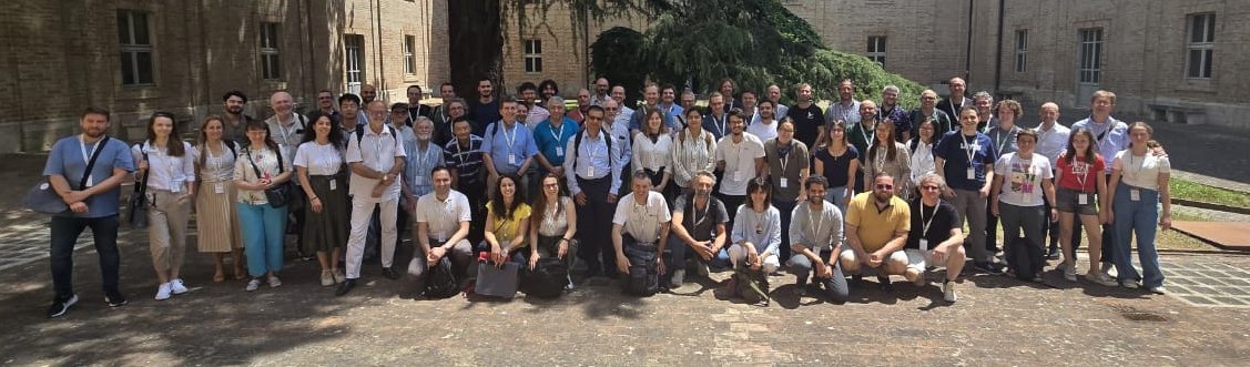
It was really hot but were happy!