The International LIDAR Mapping Forum (ILMF) took place in Denver CO from March 3-5 2010. The event drew more than 500 attendees and 60 exhibiting companies.The program placed both an emphasis on research and innovations. At ILMF 2009, ASPRS (American Society for Photogrammetry and Remote Sensing) incorporated a special LiDAR ‘hot topics’ session that tackled the challenge of developing standards and best practices for the industry. The workshop was extremely well attended and they will be hosting another session at ILMF 2010.
Geospatial Technologies & Geomorphological Mapping
October 15 to 17, 2010 - University of South Carolina - Columbia, SC
Tentative Program Schedule (subject to revision)
Friday, October 15th
- 11:30-12:30 Registration
- 12:30-5:00 Field trip to Congaree National Monument led by John Kupfer, Kimberly Meitzen, and Will Graf
- 6:30-10:00 pm Icebreaker & Registration in Top of Carolina, Capstone Building (revolving restaurant with overview of Columbia)
Saturday, October 16
- 7:30-8:30 Continental Breakfast & Poster Setup
- 7:30-10:00 Registration and proceedings volume sales
- 8:30-10:00 Session I - INTRODUCTIONS
- 8:30 – 8:40 Welcome to Columbia – Will Graf, Interim Associate Dean for Research, College of Arts and Sciences, USC
- 8:40 – 9:10 Convocation: Taking the Measure of a Landscape - Alan D. Howard, University of Virginia.
- 9:10 – 9:40 Introduction: Concepts, Issues, and Research Directions - Michael P. Bishop, University of Nebraska, Omaha; Stephen Walsh, University of North Carolina, Chapel Hill; Allan James, University South Carolina.
- 9:40 – 10:10 Coffee Break & Poster Session I
- 10:10-12:30 Session II – REMOTE SENSING, Methods and Technology
- 10:10 – 10:40 Mapping Surface Mineralogy Using Imaging Spectrometry - Fred A. Kruse , University of Nevada, Reno.
- 10:40 – 11:10 Airborne and Terrestrial LiDAR Technology for Assessing Topography, Michael Hodgson and John R. Jensen, University South Carolina.
- 11:10 – 11:40 Microwave Remote Sensing, Scott Hensley, Jet Propulsion Lab.
- 11:40 – 12:10 Recent Developments in Geophysical Methods for Landform Studies - Remke L. Van Dam, Michigan State University.
- 12:10 – 12:30 Discussion
- 12:30-1:30 Lunch (BGS Steering Committee Meeting)
- 1:30-3:30 Session III – REMOTE SENSING, Applications
- 1:30 – 2:00 Making Riverscapes Real - Patrice Carbonneau, University of Durham; Mark A. Fonstad, Texas State University, San Marcos; W. Andrew Marcus, University of Oregon; S. J. Dugdale, APEM Ltd., Riverview, Embankment Business Park, Heaton Mersey, United Kingdom.
- 2:00 – 2:30 High-Resolution Mapping and Modeling of Floodplains - James Brasington, University of Aberystwyth, UK.
- 2:30 – 3:00 Snow distribution in the Wind River Range, Wyoming: the influence of topography and regional climate – Dorothy Hall, NASA
- 3:00 – 3:30 Coffee Break & Poster Session II
- 3:30 – 5:00 Session IV – GEOGRAPHIC INFORMATION SCIENCE
- 3:30 – 4:00 Geomorphometry, Landform Representations, and Geomorphic Mapping - Ian Evans, Durham University, UK.
- 4:00 – 4:30 Digital Terrain Modeling - John Wilson, University of Southern California.
- 4:30 – 4:30 Scientific Visualization of Landscape and Landforms - Helena Mitasova, North Carolina State University.
- 4:30 – 5:00 Discussion
- 7:00-9:00 pm Banquet
- Spatial Scale in Geomorphology - Jonathan D. Phillips, University of Kentucky.
Sunday, October 17th
- 8:00-9:00 Continental Breakfast & Poster Session III
- 9:00-12:00 Session V –GEOGRAPHIC INFORMATION SCIENCE
- 9:00 – 9:30 Spatial Analysis and Mapping in Geomorphology - Thomas R. Allen, East Carolina University.
- 9:30 – 10:00 Soil Mapping and Modeling - Jon Pelletier, University of Arizona.
- 10:00 – 10:30 GIS-based Hydrological Modeling and Mapping - Lawrence Band, University of North Carolina, Chapel Hill.
- 10:30 – 11:00 Landscape Evolution Modeling and Mapping - Peter Koons, University of Maine
- 11:00 – 11:30 Geospatial Analysis and Time: Historical Reconstructions and Change Detection - Allan James and Subhajit Ghoshal, University of South Carolina, Mary Megison, Michael Singer, and Rolf Aalto.
- 11:30-12:00 - Discussion
- 12:00 Adjourn
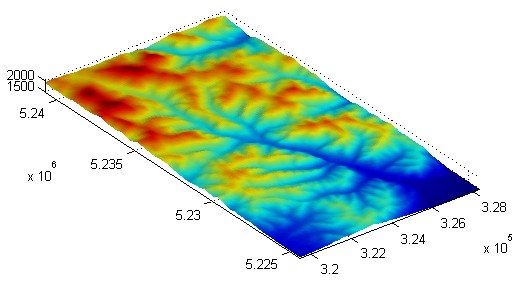
Short title: streams_error
A Sextante implementation of these algorithms called FlowTools can be obtained here (contributed by Daniel Nüst). The project report can be downloaded as a PDF. You can access the Eclipse project “flowTools” in the following public Subversion repository:
http://svn.xp-dev.com/svn/FlowTools/
You can also download an initial version (might be outdated!) of the project folder as a zip file (12).
Purpose and use:
Extraction of stream networks from a DEM using error propagation technique.
Programming environment: R / S language
Status of work: Public Domain
Reference: On the uncertainty of stream networks derived from elevation data: the error propagation approach
Data set name: Baranja hill
Attachment:
Wolfgang Schwanghart from the Geographisches Institut, Universität Basel has recently released a toolbox that allows analysis of relief and flow pathways in digital elevation models in Matlab. The toolbox can be used to visualize DEMs, extract simple derivatives, run (and modify) flow models, delineate drainage basins, produce hydrographs and implement similar DEM-based hyrdological analysis. For more info see the User Guide to TopoToolbox.
When you use TopoToolbox in your work, please refer to this publication:
Schwanghart, W., Kuhn, N. J. (2010): TopoToolbox: a set of Matlab functions for topographic analysis. Environmental Modelling & Software, in press.
Short title:geomorph
For a complete description of the processing steps, see the original publication.
Purpose and use:
Automated extraction of geomorphological features using digital elevation data: case study Drente; outputs: extracted classes and summary statistics; various plots and images.
Programming environment:R / S language
Status of work:Public Domain
Reference:{Semi-automated identification and extraction of geomorphological features using digital elevation data}
Data set name:Boschoord case study
Attachment:
Latest Posts
Dear geomorphometry community,
We are pleased to invite submissions for a cover design contest for the second edition of the Geomorphometry book, to be published in 2026.
The submissions will be gathered in a poll, and the entire community will be able to vote for their favorite design.
If your design is selected, you will receive the appropriate credits, but would need to provide the necessary permissions to use the image.
You can submit your design by email before October 17th. Please ensure that the image is of at least 300 dpi resolution.
Get designing!
The editors,
Hannes Reuter
Carlos Grohmann
Vincent Lecours
Recent Research Progress in Geomorphometry in China
Dr. Li-Yang Xiong
Nanjing Normal University, China

October 1st , 2025
8:00 MDT (UTC -6), 10:00 EDT (UTC -4), 11:00 BRT (UTC - 3), 15:00 BST (UTC +1), 16:00 CEST (UTC +2), 17:00 EEST (UTC +3), 22:00 CST (UTC +8)
Recording available in our YouTube channel
Bio: Dr. Li-Yang Xiong is a professor at the School of Geographical Science, Nanjing Normal University (NNU), China. He is currently responsible for managing NNU’s research in Digital Terrain Model and Digital Terrain Analysis. His main research interests include AI based terrain modelling, loess terrain feature characterization, landform evolution modeling, paleotopography reconstruction and geomorphological process mining. His recent work involves deep learning-based DEM reconstruction, geomorphology-oriented digital terrain analysis, and value-added digital terrain applications for geoscience. He also serves as Associate Editor for the journal Earth Surface Processes and Landforms and as an Editorial Board Member for International Journal of Geographical Information Science.
Abstract: In this talk, I will present some recent research achievements related to terrain modelling theory, terrain analysis method and terrain application in China. This terrain modeling theory focused on how we understand terrain knowledge and integrate it into AI methods for terrain reconstruction. In term of the terrain analysis method, the mathematical vector operation we believe should be highlighted in the research of Geomorphometry, which is suitable for multi-source data structure by considering the directional property of terrain parameters. Actually, this directional property should be made a full consideration for process- oriented geographical modeling and simulation. Lastly, I will show some terrain applications towards different typical geographical areas in China as well as global scale application.
Dear colleagues,
I’m grateful if you can circulate information on this PhD opportunity in Italy. The potential candidates can contact me (strevisani@iuav.it) for further information. Here the main elements of the position:
Research topics: Predicting and supporting benthic and pelagic biodiversity through geomorphometry and machine learning
Link to the call (Italian and English): https://www.unipa.it/didattica/dottorati/dottorato-xli/bando-di-accesso-ciclo-41/
Position code [BIODIV.OGS]
Research headquarters OGS Trieste and University of Palermo
Funded by OGS - Istituto Nazionale di Oceanografia e di Geofisica Sperimentale
Key dates: Deadline: 7th August 2025 - 14:59 (Italian time)