Blog

Cover Design Contest for the Upcoming Book on Geomorphometry

Dear geomorphometry community,

We are pleased to invite submissions for a cover design contest for the second edition of the Geomorphometry book, to be published in 2026.

The submissions will be gathered in a poll, and the entire community will be able to vote for their favorite design.

If your design is selected, you will receive the appropriate credits, but would need to provide the necessary permissions to use the image.

You can submit your design by email before October 17th. Please ensure that the image is of at least 300 dpi resolution.

Get designing!

The editors,
Hannes Reuter
Carlos Grohmann
Vincent Lecours

Coffee Talk - Recent Research Progress in Geomorphometry in China

Recent Research Progress in Geomorphometry in China

Dr. Li-Yang Xiong
Nanjing Normal University, China

October 1st , 2025
8:00 MDT (UTC -6), 10:00 EDT (UTC -4), 11:00 BRT (UTC - 3), 15:00 BST (UTC +1), 16:00 CEST (UTC +2), 17:00 EEST (UTC +3), 22:00 CST (UTC +8)

Recording available in our YouTube channel

Bio: Dr. Li-Yang Xiong is a professor at the School of Geographical Science, Nanjing Normal University (NNU), China. He is currently responsible for managing NNU’s research in Digital Terrain Model and Digital Terrain Analysis. His main research interests include AI based terrain modelling, loess terrain feature characterization, landform evolution modeling, paleotopography reconstruction and geomorphological process mining. His recent work involves deep learning-based DEM reconstruction, geomorphology-oriented digital terrain analysis, and value-added digital terrain applications for geoscience. He also serves as Associate Editor for the journal Earth Surface Processes and Landforms and as an Editorial Board Member for International Journal of Geographical Information Science.

Abstract: In this talk, I will present some recent research achievements related to terrain modelling theory, terrain analysis method and terrain application in China. This terrain modeling theory focused on how we understand terrain knowledge and integrate it into AI methods for terrain reconstruction. In term of the terrain analysis method, the mathematical vector operation we believe should be highlighted in the research of Geomorphometry, which is suitable for multi-source data structure by considering the directional property of terrain parameters. Actually, this directional property should be made a full consideration for process- oriented geographical modeling and simulation. Lastly, I will show some terrain applications towards different typical geographical areas in China as well as global scale application.

Summary of Geomorphometry 2025

As in previous editions, the 2025 event in Perugia, Italy, aimed at providing a forum for researchers working on different aspects of quantitative terrain analysis, fostering dialogue between methodological developments and applied studies. This volume reflects both continuity and innovation within the field, bringing together contributions that address long-standing conceptual issues as well as emerging challenges associated with new data sources, computational paradigms, and application across diverse environments and spatial scales.

We have identified three groups of contributions for this volume: 1) data and methods, 2) Landform and processes, and 3) georesources and geoheritage. Papers in group 1) and 2) are further split into subgroups, while group 3) collects contributions about georesources, geoheritage, and geodiversity.

The latter group, with the keynote talk by Prof. Zwolinski, represented the project “URban Geodiversity for a Resilient Environment, URGERE”, sponsoring the conference. Moreover, during the conference, the upcoming new edition of the book “Geomorphometry: concepts, software, applications” edited by H. I. Reuter, C. H. Grohmann, and V. Lecours was presented. Additional side events took place. First, the DEMIX (DEM Intercomparison eXercise) collaboration, a CEOS / WGCV / TMSG initiative supported by ESA as part of the EDAP+ project and by USGS, presented several contributions, culminating with the final DEMIX CEOS-TMSG meeting. Second, the AIGeo Working Group “Sistemi e tecnologie integrate per l’analisi morfotettonica, SISTEC” presented their contributions and held their side meeting during the event. The last full day of the conference was devoted to four hand-on workshops, held in a computer lab, in which participants were invited to experiment with different practical applications of Geomorphometry.

During the conference, the International Society for Geomorphometry council awarded the customary Lifetime Achievement Award to Prof. David Tarboton, for his outstanding contributions to Geomorphometry: the 2011-2023 hall of fame of the award is listed on the conference website. Moreover, the conference attendees voted for a few additional awards: the best student papers/presentations were awarded to joint winners Andrei Ionita and Arianna Negri, and the best paper/presentation was awarded to Massimiliano Alvioli.

Here follows a short description of all the contributions to the conference, including keynote talks by Sebastiano Trevisani, David Tarboton, and Zbigniew Zwoliński.

Group 1.1, Data and methods: Digital elevation models.

A substantial number of contributions focus on digital elevation models and on the methods used for their generation, processing, and evaluation. Several studies address global and regional DEM products and examine the implications of their characteristics for geomorphometric analysis. Guth discusses recent developments related to DEMIX activities, emphasizing data integration and consistency, while Corseaux et al. present complementary contributions on DEMIX platform development, addressing harmonization of processing workflows and interoperability. Pronk et al. provide a qualitative comparison of corrected global DEMs, highlighting their suitability and limitations for geomorphometric applications, and Panza et al. analyze high-resolution DTMs over selected areas, discussing the effects of data quality on derived terrain attributes. Issues related to scale and abstraction are addressed by Feciskanin et al. and Hajduchová et al., who investigate DEM generalization techniques and their ability to preserve geomorphological information. The potential of high-resolution remote sensing is further explored by López-Vázquez et al., who examine the enrichment of LiDAR datasets through partial derivatives, by Ho et al., who analyze global DEM products from a comparative perspective, and by Vinci et al. and Zamboni et al., who present UAV- and drone-based surveys for detailed terrain mapping. Noman et al. complement these contributions by discussing cloud-based environments for DEM processing, reflecting the increasing importance of scalable computational infrastructures.

Group 1.2, Data and methods: Land surface analysis.

Several papers address land-surface analysis and the definition, computation, and interpretation of geomorphometric parameters. The concept of surface roughness, widely used but often ambiguously defined, is revisited in the keynote talk by Trevisani, who critically examines its geomorphological meaning, and by López-Vázquez et al., who analyze formal inconsistencies in commonly adopted roughness metrics. Qin et al. propose fuzzy slope position indices as an alternative framework for land-surface characterization. Guth revisits slope algorithms, arguing for robust and parsimonious formulations, while Lindsay explores elevation residuals using scale mosaics to investigate terrain structure across spatial scales. Evans introduces a concavity-related metric based on the profile integral, contributing to long-standing discussions on slope and curvature descriptors. Feciskanin et al. present a software tool for calculating land-surface parameters, explicitly addressing issues of scale dependency and parameter stability.

Group 1.3, Data and methods: Hydro-Geomorphological features

Hydro-geomorphological features and terrain representations relevant to hydrological analysis are examined in several contributions. Tarboton presented his keynote talk about reflections on the conceptual links between geomorphometry and hydrology, emphasizing terrain controls on flow processes. Alvioli et al. present an automated approach for delineating nested slope units, supporting objective terrain partitioning. Lindsay introduces a minimal dispersion flow algorithm aimed at improving flow-routing accuracy, while Peckham et al. review methods for computing channel slope from DEMs, highlighting unresolved methodological issues. The influence of DEM characteristics on river network extraction is analyzed by Basta et al., while Newman et al. propose a probabilistic framework for surface change detection that explicitly accounts for uncertainty. Retat et al. focus on river centerline extraction, and Delchiaro et al. analyze bankfull geometry variations, illustrating how geomorphometric tools can support fluvial studies.

Group 2.1, Landform and Processes: Landslides.

A large portion of the volume is devoted to landforms and geomorphological processes, with landslide-related studies representing a particularly prominent theme. Mancino et al. present a global landslide susceptibility analysis based on ensemble machine-learning approaches, while Grohmann et al. investigate the influence of data resolution on susceptibility modelling. Sarkar et al. focus on rockfall susceptibility along transportation corridors, and Fabbri et al. discuss landslide susceptibility modelling with particular attention to curve interpretation and uncertainty. Debris-flow processes are examined by Goetz et al. and Bornaetxea et al., who address detection and susceptibility at different spatial scales. Nguyen et al. explore landslide detection using Google Earth imagery, Stark et al. analyze landslides using LiDAR data, Romeo et al. provide a geohazard assessment perspective based on gigapixel imagery, Contillo et al. investigate landslide morphometry, Strohmaier et al. analyze rainfall–landslide relationships, and Ahmed et al. contribute additional insights into landslide processes.

Group 2.2, Landform and Processes: Fluvial processes.

Fluvial and erosional processes are addressed through studies of soil erosion, gully development, and badlands morphology. Rigon et al. analyze soil erosion using multi-temporal DEMs, Bufalini et al. and Cuvuliuc et al. focus on gully erosion processes, and Marsico et al. investigate badlands morphology using combined terrestrial laser scanning and UAV data.

Group 2.3, Landform and Processes: Glacial processes.

Glacial environments are represented by Parizia et al., who analyze glacial landforms and their evolution, and by Chiarini et al., who focus on subglacial features derived from DEM analysis.

Group 2.4, Landform and Processes: Tectonic processes.

Geomorphometry is also applied to tectonic and morpho-structural analysis. Contillo et al. investigate fault-related landforms, while Brunori et al. analyze surface expressions associated with recent seismic sequences. Muneeb et al. integrate high-resolution airborne LiDAR with geomorphometric and structural analyses to characterize the Monte Cefalone Fault, demonstrating how detailed DEMs support fault scarp identification, throw measurement, and tectonic interpretation.

Group 2.5, Landform and Processes: Landform classification.

Several contributions address landform classification and the broader application of physical geomorphometry. Lecours et al. focus on landform characterization in marine and terrestrial settings, Ionita et al. present a national scale landform classification, Brenning et al. apply geomorphic distribution modelling to desert environments, and Popov et al. discuss applications of physical geomorphometry in classification workflows.

Group 2.6, Landform and Processes: Physical and other surface processes.

Advances in physical geomorphometry are further discussed by Minár et al., while Supiński et al. extend geomorphometric analysis to cave environments. Jarzyna et al. investigate weathering processes using geomorphometric approaches, Ragazzo et al. focus on marine environments, and Mazzoglio et al. analyze the role of elevation in rainfall extremes, linking geomorphometry and hydro-climatology.

Group 3, Georesources and Geoheritage.

The final set of contributions highlights applications related to georesources and geoheritage. Zwoliński et al. address in his keynote talk geodiversity assessment, Burnelli et al. propose a geomorphodiversity index at national scale, Negri et al. discuss geomorphometry in the context of geoparks, Calderón et al. focus on mapping and reconstruction of pre-anthropogenic topography, Moudrý et al. present a global assessment of mining activities, and Solarski et al. analyze mining-related landscape changes using historical cartography.

From the Introduction of the volume: M. Alvioli, L. Melelli, I. Marchesini, (2026). Proceedings of Geomorphometry 2025, 9-13 June, Perugia, Italy. CNR Edizioni, Rome. ISBN 978 88 8080 765 0. DOI: https://doi.org/10.30437/gmft25pg

Original Conference Website: https://www.geomorphometry2025.org
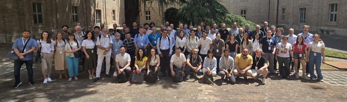

It was really hot but were happy!

PHD position in Italy

Dear colleagues,

I’m grateful if you can circulate information on this PhD opportunity in Italy. The potential candidates can contact me (strevisani@iuav.it) for further information. Here the main elements of the position:

Research topics: Predicting and supporting benthic and pelagic biodiversity through geomorphometry and machine learning

Link to the call (Italian and English): https://www.unipa.it/didattica/dottorati/dottorato-xli/bando-di-accesso-ciclo-41/

Position code [BIODIV.OGS]

Research headquarters OGS Trieste and University of Palermo

Funded by OGS - Istituto Nazionale di Oceanografia e di Geofisica Sperimentale

Key dates: Deadline: 7th August 2025 - 14:59 (Italian time)

ANADEM: A Digital Terrain Model for South America

There is a new paper (open access) describing a Machine Learning-based DTM for South America:

Laipelt L., Andrade B.C., Collischonn W., Teixeira A.A., Paiva R.C.D., Ruhoff A., 2024. ANADEM: A Digital Terrain Model for South America. Remote Sensing 16(13):2321. https://doi.org/10.3390/rs16132321

Latest Posts

Whitebox Workflows Next Gen released

Whitebox Workflows Next Gen, a complete rewrite of the Whitebox geospatial analysis platform, is now publicly available for Python, R, and QGIS.

Built from the ground up in pure Rust, Whitebox Next Gen provides more than 700 geospatial analysis tools for geomorphometry, terrain analysis, spatial hydrology, LiDAR processing, remote sensing, vector GIS, and spatial statistics. All three interfaces run on the same high-performance backend, allowing users to work in scripts, notebooks, statistical workflows, or a familiar desktop GIS environment.

Whitebox Next Gen is not an incremental update to the previous Whitebox architecture. It replaces the earlier monolithic system with a modular, full-stack geospatial platform. Core capabilities for raster and vector I/O, coordinate systems and reprojection, vector topology, spatial indexing, LiDAR processing, and other foundational operations are implemented directly within the Whitebox codebase rather than delegated to external C or C++ GIS libraries. This approach provides consistent cross-platform behaviour, fewer system-level dependencies, tighter control over performance and correctness, and greater flexibility for continued research and development

Highlights

  • More than 700 tools for geomorphometry, hydrology, LiDAR, remote sensing, vector analysis, spatial statistics, and general geospatial processing
  • Publicly available interfaces for Python, R, and QGIS
  • A modular, high-performance backend written entirely in Rust, including wbprojection, wbraster, wbvector, wblidar, wbspatialstats, and wbtopology open-source (MIT/Apache licensed) backend libraries
  • Most of the 80+ tools that existed within the previous extension product have been migrated to the new Whitebox open core, including the tools for advanced surface curvature analysis and DEM processing
  • Native coordinate-reference-system handling and reprojection workflows via wbprojection
  • Expanded raster support (19 formats), including GeoTIFF, Cloud-Optimized GeoTIFF (COGs), GeoPackage Raster, and JPEG2000
  • Expanded vector support (12 formats), including Shapefile, GeoPackage, FlatGeobuf, GeoParquet, GeoJSON, TopoJSON, and GML
  • Modern point-cloud support, including LAS, LAZ, COPC, E57, and PLY
  • A dedicated topology engine supporting robust vector analysis, network analysis, route-event workflows, and linear referencing
  • Local-first processing on Windows, macOS, and Linux
  • A consistent analysis platform across Python scripts and R workflows
  • A newly updated and more advanced QGIS Processing toolbox

Whitebox has particular strengths in terrain analysis, geomorphometry, spatial hydrology, and LiDAR processing. Whitebox Next Gen carries these areas forward while substantially expanding the project’s capabilities for vector analysis, remote sensing, modern spatial data formats, and reproducible geospatial workflows.

Get started

The geomorphometry community is invited to explore Whitebox Next Gen, test its tools and workflows, report issues, and contribute to the continued development of the project.

DEMIX reveals which DEMs perform best

First round of the DEMIX exercise published final report

Global digital elevation models (DEMs) have become routine operational inputs across mapping, environmental monitoring, modelling and Earth-observation workflows. Their broad coverage and global availability have made them data that many practitioners simply take for granted. But knowledge of the terrain and topography of Earth’s surface is fundamental for monitoring and understanding terrestrial ecosystems and the planet’s habitability. For that reason, the CEOS Working Group on Calibration and Validation (WGCV) maintains a subgroup dedicated to digital topography and the quality of DEMs, the ‘Terrain Mapping Sub-Group (TMSG).

DEMs are representations of elevation in the form of a georectified grid, at global scale commonly derived from space-based interferometric synthetic aperture radar (InSAR) or stereoscopic optical observations, while regionally and locally airborne Laser induced detection and ranging (LIDAR) has become the primary source. DEMs can be classified as digital surface models (DSMs) when depicting the lower surface of the atmosphere or digital terrain models (DTMs) when depicting the top of the lithosphere (the Earth’s crust).

A wide variety of DEM products exist – each having different characteristics which suit different applications. It can be challenging to understand which of the available DEM products are fit for purpose for certain applications or regions. That is the practical gap addressed by the Digital Elevation Model Intercomparison Exercise (DEMIX) undertaken by TMSG. By exposing where widely used global DEMs agree, where they differ and how those differences affect rankings, the exercise delivered evidence to users for selecting a DEM rather than defaulting to one by habit.

DEM products were compared through a ‘wine contest,’ which identified requirements of openness, reproducibility, adaptability, and statistical rigour. The characteristics, evaluations, and ranking for each DEM were collected in a GIS database with over 50,000 entries. A quantitative assessment was carried out for each global DEM based on pixel-by-pixel differences of geomorphometric parameters against finer spatial resolution (1-5 m resolution) reference DEMs.

The study incorporates an unprecedented amount of high quality reference data covering a broad range of landforms and surface types, comparing their characteristics without resampling or interpolation. Users are invited to consult the results of DEMIX in order to make informed choices when needing to use a DEM, or in some cases a combination of the most relevant DEMs for their applications.

The final rankings of the wine contest, presented below, compared the six DEMs based on land cover (forest, urban, or barren), slope (cliff, steep, gentle, or flat), differences in elevation, slope and roughness, and statistical metrics.

Led by the European Commission’s Joint Research Centre (JRC), the CEOS Working Group on Calibration and Validation (WGCV) Terrain Mapping Subgroup (TMSG) established DEMIX in partnership with the International Society for Geomorphometry. Several members of the International Society of the Geomorphometry contributed significantly and we hosted various secssions at our latest conference. The exercise was performed over a three-year period starting in 2020, with community-wide calls for participation and an assembly of experts producing a number of peer-reviewed publications, culminating with a JRC reference report published in July 2026.

The objective of DEMIX was to propose a procedure to rank the available free and open global DEMs, taking into consideration user needs while promoting the implementation of FAIR (Findable, Accessible, Interoperable and Reusable) principles. The exercise compared DEMs based on criteria for land cover and terrain slope categories, representative testing, and a statistically sound ranking approach. The report outputs tailored recommendations regarding available DEM products that are not limited to one domain, geographic area, or landscape type, with flexibility for different user needs and applications.

A major challenge in the comparison of the global DEMs were the varying formats, data, and metadata contents. The adoption of a common set of standards would enhance the quality and interoperability of global DEMs and streamline the exchange and utilisation of DEM data for both providers and users. DEMIX makes the following recommendations for data providers:

● Adopt a standardised grid layout, with complete grid definitions and encodings following ISO/OGC rules.

● Include vertical datum information as part of raster DEM files.

● Clearly indicate the product version in the file names.

● Participate in future DEMIX rounds, which serve as a neutral platform for independently evaluating products before their release.

● Provide high quality, finer resolution, accurate, and multi-temporal elevation data to be used as a reference alongside DEM products.

Global DEMs are indispensable operational geospatial datasets, but they should not be treated as error-free or interchangeable. DEMIX delivered to the global community a systematic and transparent method to help choose elevation products more intelligently and help define what better elevation measurements should look like in the future.

Further Reading:

Read more in the DEMIX Final Report, or see other DEMIX publications below - mainly by our ISG members:

  • Benchmarking Elevation Plus Land Surface Parameters Finds FathomDEM and Copernicus DEM Win as Best Global DEMs (2025) and subsequent discussion (2026a, 2026b)
  • Ranking of 10 Global One-Arc-Second DEMs Reveals Limitations in Terrain Morphology Representation 2025
  • Novel Approach for Ranking DEMs: Copernicus DEM Improves One Arc Second Open Global Topography (2024)
  • Digital Elevation Models: Terminology and Definitions (2021)
  • The Digital Elevation Model Intercomparison eXperiment DEMIX, a community-based approach at global DEM benchmarking (2021)

Coffee Talk - GeoNadir

Building the world’s largest repository of FAIR drone mapping data

Paul Mead GeoNadir

September 2nd, 2026
11:30 (UTC)

Bio: Paul Mead is Co-founder and Head of Business & Strategy at GeoNadir, a platform building the world’s largest repository of FAIR drone mapping data to support environmental decision-making. A non-technical co-founder, Paul focuses on strategy, commercial development, and building high-performing teams — a discipline shaped by 11 years in the New Zealand Army, including leading a bomb disposal team in Lebanon and service in Afghanistan and the Asia-Pacific region. Since 2013 he has built and led several small businesses and start-ups, with drones as a central technology since 2016. Alongside GeoNadir, Paul co-founded She Maps, an internationally recognised drone and geospatial STEM education organisation, and has helped raise over $7M in equity and non-equity funding across his ventures. He holds a Master of Philosophy from the University of Queensland and is a Chartered Manager.

Abstract: GeoNadir set out to build the world’s largest repository of FAIR drone mapping data, and ended up building something more powerful. Drones have democratised data capture, but the same democratised ability to generate decision-grade insights from the data is lacking. I’ll walk through how we’re closing that gap: the data infrastructure behind hosting large volumes of UAV imagery and derived products, and how we’re moving from manual analysis toward automated, repeatable geospatial analytics.